- 463 7th Ave, NY 10018, USA
- +1 (212)-695-1962
- info@elementskit.com
Specialist tools for flight procedure design and obstacle assessment, developed in accordance with applicable aviation standards to support aviation professionals.
Developed around applicable ICAO standards and recommended practices.
Designed for aviation professionals and flight procedure designers.
Tools for technical calculations, visualization, and engineering workflows.
GACS provides specialized aviation engineering software for flight procedure design, obstacle assessment, and related technical tasks. Explore our two Geo-Design solutions to identify the workflow most relevant to your project.
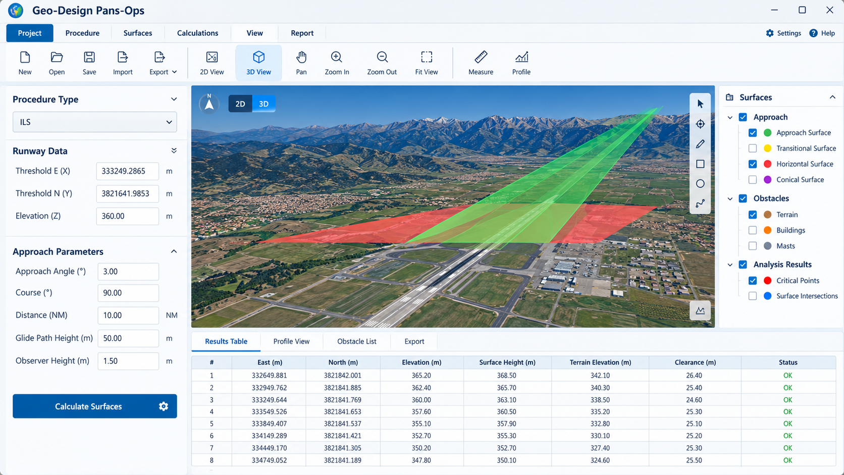
Geo-Design Pans-Ops is developed according to ICAO criteria (Doc. 8168) and is a status symbol in the world of aviation. This software supports IFP designers in the calculation, design and drawing of flight procedures for all flight phases, including approach, landing and departure.
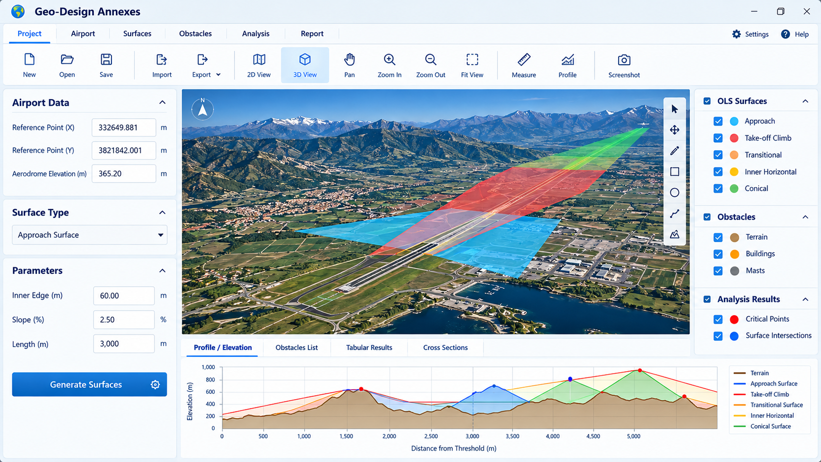
Geo-Design Annexes is developed according to ICAO criteria (Annex 14 and Annex 15) and supports the calculation, design and drawing of obstacle limitation surfaces (OLS) and related assessments for airports and air navigation service providers.
Flight procedure design based on ICAO Doc. 8168.
Obstacle limitation surfaces based on Annex 14 and 15.
Our team is ready to advise you on the most suitable solution for your projects and provide technical support and training.

Providing specialised aviation consultancy services and software to support safe, efficient and compliant aviation development worldwide.
© 2026 Global Aviation Consultancy Services. All rights reserved.